
Watershed Health
What is watershed health?
Watershed health may be measured using a variety of metrics, including land condition, hydrology, geomorphology, habitat, biological condition, and water quality. Vulnerability assessments may be accomplished using land use change, water use and wildfire.[i]
[i] US Environmental Protection Agency, Office of Water Healthy Watersheds Program (2017) Overview of the Preliminary Healthy Watersheds Assessments Project: Evaluating Relative Health and Vulnerability of Conterminous US Watersheds, February 2017
Why is watershed health important?
A healthy watershed provides many benefits:
- Provides erosion and flood control
- Protects property and property values
- Affords recreational opportunities (fishing, birdwatching, trails, rafting)
- Attracts businesses and tourism (outdoor recreation, retail, restaurants)
- Provides water for irrigated agriculture and farm animals
- Supports wildlife habitat and migration corridors
- Sustains plant life (land and aquatic) and wildlife (water, food, shelter)
- Improves biological diversity (wetlands, river corridors)
- Supports plant life (land and aquatic) and wildlife (water, food, shelter)
- Protects species of concern, threatened and endangered species
- Provides ecosystem services (helps retain sediment, filters pollutants, promotes nutrient cycling, affords carbon sequestration opportunities, supports pollinators)
- Reduces infrastructure costs for drinking water treatment (surface and ground water)
- Reduces flood mitigation costs
- Protects local air quality (naturally occurring metals and particles from soil and wildfires)
- Makes communities more resilient to extreme weather events
- Reduces invasive and non-native species
- Gives physical and mental health benefits (exercise, stress relief)
How does watershed health affect quality of life in the Pikes Peak Region?
Factors that affect watershed health and quality of life in the Pikes Peak Region and beyond include, but not limited to, changes in land condition from population growth, land use and urban development as well as the impacts from climate change. These factors:
- Degrade stable natural environments by removing vegetation through activities such as mining and forest fires
- Increase the frequency, intensity, and rate of runoff
- Increase risks of wildfire in the urban-wildland interface, forests, and grasslands
- Change base flows caused by transfers from other basins into the watershed or conditions within the watershed such as drought
- Increase runoff carrying debris and pollutants from burned areas and other degraded natural areas
- Imperil human health, life, and property
- Harm water quality resulting from erosion, litter, chemical and biological pollutants (point and nonpoint sources[i], chemical spills, and brownfields[ii])
- Increase opportunity for establishment of invasive and noxious plant species
- Interfere with biodiversity, movement, and health of native aquatic and land species
- Reduce groundwater recharge and contaminate wells used for drinking water and agriculture
- Increase costs of drinking water treatment for downstream users
- Affect the quality and amount of water available for agricultural irrigation
- Increase costs for maintenance, repair, and replacement of infrastructure due to flooding or drought (irrigation diversion structures, utility pipelines, poles and treatment plants, local roads, etc)
- Reduce economic and social well-being
[i] US Environmental Protection Agency (n.d.) Basic Information about Nonpoint Source (NPS) Pollution. Retrieved from https://www.epa.gov/nps/basic-information-about-nonpoint-source-nps-pollution Oct 2021
[ii] U.S. Environmental Protection Agency (n.d.) Overview of EPA’s Brownfields Program Retrieved from https://www.epa.gov/brownfields Mar 2024
DISCLAIMER
Information for this webpage was originally compiled and submitted by the author as part of the Peak Progress: Quality of Life Indicators (QLI) update published in 2022 by the Pikes Peak United Way. It is intended to describe the health and current condition of the Fountain Creek Watershed. It provides a basis for describing how well the watershed is functioning; how it may be affected in the future by wildfire, drought, extreme weather, population growth, urban development, and pollution; and possible initiatives to protect and conserve it for current and future generations. Last updated by the author February 2024.
Watershed Health FCWD v1a.docxConditions on Fountain Creek
- Rivers and streams, including Fountain Creek and its tributaries, naturally flood from time to time.
- Flooding occurs when a land area sheds precipitation in an amount and period of time that causes its waterways to spill out of their banks.
- A floodplain consists of two parts: the main channel itself and the adjacent land area that becomes inundated with floodwater.
- In the past Fountain Creek and some of its tributaries flooded only during spring runoff.
- Now Fountain Creek runs year-round because of water pumped to the Pikes Peak Region from the western slope and discharged from wastewater systems and irrigation.
- Floodwaters often cause or lead to erosion and increased sediment in the creek.
- Erosion can lead to steep banks, sluffing of soil into the creek, loss of land and property damage such as fences, roads and buildings, and water diversion structures.
- Sediment can clog irrigation intake structures, change the course of the creek and damage plant and animal life.
- Communities, project managers, and individuals contemplating projects in or near waterways may be required to obtain a regulatory permit from the US Army Corps of Engineers. The ACOE regulatory program “involves the regulating of discharges of dredged or fill material into waters of the United States and structures or work in navigable waters of the United States, under section 404 of the Clean Water Act and section 10 of the Rivers and Harbors Act of 1899. A proposed project’s impacts to these areas will determine what permit type is required.”[i]
[i] US Army Corps of Engineers, Obtain a Permit (n.d.) Retrieved Feb 2024
Growth and Development
- The population of El Paso County is expected to exceed 1,000,000 by 2049 according to the Colorado State Demography Office[i]
- Population growth generates an increasing demand for housing, businesses and governmental services and contributes to sprawl in the Pikes Peak region.
- Sprawl converts substantial portions of natural land cover to impervious surfaces and consequently creates more stormwater runoff.
- Natural land cover and rural lands allow water to seep in and recharge aquifers; by doing this, they also reduce the intensity and volume of runoff.
- Urban, suburban, and exurban development and redevelopment typically increase impervious surfaces (rooftops, roads, and other hard surfaces).
- Impervious surfaces create higher volumes and rates of runoff than surfaces that allow water to seep into the ground (pervious surfaces).
- Impervious surfaces typically carry nonpoint pollution (oil from pavement, litter, sediment, pet waste, lawn chemicals, road salt and other contaminants) into stormwater drains and systems that convey it into waterways.
- Flash flooding may occur from heavy rainfall in a short period of time or fast melting snow, which is made more likely in urban or developed areas.
- Water from hard surfaces entering Fountain Creek and its tributaries contribute to erosion, sedimentation, and flooding.
- Erosion, sedimentation, and flooding cause property damage along creek banks.
- Litter, leaves, and other material in stormwater can clog storm drains and exacerbate local flooding causing water to back up into homes or the street and potentially resulting in property damage.
- Flooding may also lead to loss of native animal habitat and imperil human and animal life.
- Infrastructure such as buildings, roads, and recreational trails in the 100-year floodplain can disrupt natural flows and floodplains that contribute to property damage.
- "Depending on how much rain falls, creeks in the Fountain Creek watershed may be dry, gently flowing, or a raging torrent. A floodplain is the area of land that is likely to be under water when the creek rushes over its banks. In a sense, the floodplain is the full extension of the creek.
- The 100-year floodplain is the land predicted to flood during a 100-year storm which has a 1% chance of occurring in any given year. You may also hear the 100-year floodplain called the 1% annual chance floodplain or base flood. Areas within the 100-year floodplain may flood in smaller storms as well. The Federal Emergency Management Agency (FEMA) uses the 100-year floodplain to administer the federal flood insurance program."[ii]
- Most communities in the watershed now prohibit or tightly control new construction and camping in the 100-year floodplain.
- Colorado Springs and some surrounding communities have incorporated green infrastructure, low impact development (LID)[iii] and stormwater best management practices (BMPs) into drainage criteria manuals used by planners and developers to minimize stormwater impacts.[iv]
- Increased development in the wildland-urban interface (WUI) creates risk to life and property from wildfire and increased runoff and debris from burned areas. The WUI is the area where human development intersects with the natural environment. In addition to an elevated risk from wildfire, development in the WUI causes habitat fragmentation, loss of biodiversity and introduction of exotic species.
- Other types of Infrastructure may affect creek structure and function in good or bad ways such as utilities, roads and bridges, channel bank stabilization, channel realignment, increased baseflow discharge, increased sedimentation and erosion.
- Population growth and development calls for financial and other resources from developers, citizens, utilities, and governments to provide basic services and to prepare and respond to natural disasters such as wildland fire, flooding, drought, extreme weather, higher temperatures, property loss, and other risks.
[i] The Colorado Springs Area is on track to reach 1 million people. Will bigger be better? (2023, updated 2024) Retrieved from The Gazette, https://gazette.com/business/the-colorado-springs-area-is-on-track-to-reach-1-million-people-will-bigger-be/article_87a38678-7453-11ee-bf99-7bcf7395fd4a.html Feb 2024
[ii] Adapted from City of Austin (n.d.) What is a floodplain? What is the 100-year floodplain? Retrieved from https://austintexas.gov/faq/what-floodplain-what-100-year-floodplain Oct 2021
[iii] US Environmental Protection Agency (n.d.) Urban Runoff: Low Impact Development Retrieved from https://www.epa.gov/nps/urban-runoff-low-impact-development#:~:text=The%20term%20low%20impact%20development%20%28LID%29%20refers%20to,to%20protect%20water%20quality%20and%20associated%20aquatic%20habitat Nov 2021
[iv] US Environmental Protection Agency Publication EPA 231-B-05-002 (2005) Using Smart Growth Techniques as Stormwater Best Management Practices
Resources and Additional Information
Peak Progress: Quality of Life Indicators, Pikes Peak United Way, Watershed Health
Pikes Peak Regional Office of Emergency Management
Pikes Peak Regional Emergency Preparedness and Safety Guide, Feb 2023 Retrieved .2/22/2024
Pikes Peak Regional Emergency Response Management, Emergency Operations Plan 2021 Retrieved 02/22/2024
DISCLAIMER
Information for this webpage was originally compiled and submitted by the author as part of the Peak Progress: Quality of Life Indicators (QLI) update published in 2022 by the Pikes Peak United Way. It is intended to describe the health and current condition of the Fountain Creek Watershed. It provides a basis for describing how well the watershed is functioning; how it may be affected in the future by wildfire, drought, extreme weather, population growth, urban development, and pollution; and possible initiatives to protect and conserve it for current and future generations. Last updated by the author February 2024.
Point and Nonpoint Sources
Water quality in the watershed may be affected by both point and nonpoint sources. Point sources or discrete discharge locations such as a wastewater treatment plant or stormwater collection system are regulated by the Colorado Department of Health and Environment or the US Environmental Protection Agency through the issuance of discharge permits. The permits restrict and limit the types and amounts of specific pollutants that may be discharged into area streams.[i]
- Spills such as motor oil and overflows from sewage treatment plants may cause disruptions to water quality on land and in creeks.
- Non-regulated contaminants in runoff and wastewater may include pharmaceuticals, microplastics and other chemicals. Consideration of such contaminants may be warranted to protect human health and the environment.
- Treated wastewater may be used for irrigation of some types of landscaping.
- Untreated ground or surface water may also be used for irrigation.
- Wastewater treatment systems that purify water for drinking may be considered by providers in the future.
Nonpoint Pollution
Nonpoint pollution sources originate from nondiscrete or dispersed sources. These sources are not captured or treated and flow directly into streams or infiltrate groundwater.
- Water quality issues in the watershed include Escherichia coli (E. coli), metals and temperature. Polyfluoroalkyls (PFAS), often called forever chemicals and highly resistant to breaking down in natural systems, have been discovered. Other constituents of concern include nutrients (often introduced to the environment from agricultural activities), sediment, and metals from human-caused activities.
- Unauthorized camping or other uses along creeks damage vegetation that can lead to increased runoff, erosion, and soil loss.
- Encampments contribute to human waste, litter, and other contaminants in Fountain Creek.
- Rural land use (livestock, agricultural runoff, on-site wastewater treatment-septic tanks, water rights/diversions) however, may also contribute pollutants to surface water and groundwater.
- Surface water quantity and quality affects shallow aquifers and vice versa. Contaminants in one may affect the other.
- Ground water may contain minerals and naturally occurring radionuclides from the geology of underground formations and must usually be treated to reduce or remove them for use as drinking water.[ii]
- Groundwater has been shown to contain PFAS in the Fountain Valley[iii]
- What is Nonpoint Source Pollution Fact Sheet, Colorado Water Protection Project (n.d.) Retrieved 02/28/2024
water quality concerns in fountain creek
The primary water quality concern in Fountain Creek is Escherichia coli (or E. coli). Fountain Creek is impaired for E. coli in all segments and is on the 303(d) list which is under Regulation 93.[iv]
Potential sources of e coli include waste from:
- encampments or illegal disposal
- leaking on-site wastewater treatment systems (OWTS), leaking or infiltration from sanitary sewer systems, cross connections, or sewer overflows
- pet waste
- wildlife
- livestock
PFAS represents another major pollutant of concern in the Security-Widefield-Fountain area:
- PFAS in our community originated from firefighting foam used at local airports, in particular Peterson Air Force Base and the Colorado Springs Airport.
- PFAS and other forever chemicals may also be discharged through wastewater treatment systems from manufacturing or other industrial operations.
- Communities that use local groundwater affected by PFAS have had to or will install special water treatment systems in order to use the water for drinking.
- PFAS has affected the ability of several regional water utility agencies to deliver clean water. For many water suppliers it has impacted their reputation, undermined consumer trust, and increased the cost of water. It has required water monitoring and the need to supply bottled water for consumers. To date, several water purveyors have had to install and operate, repair, and maintain new water treatment systems.
- Studies continue in order to determine the long-term health effects of PFAS exposure, which may include severe illness or death.
- At least one farm that used ground water contaminated with PFAS ceased operations temporarily because of PFAS in the groundwater, which affected local food supply, educational opportunities, and income for the farm
Other water pollution concerns in different segments or sections of Fountain Creek, its tributaries and aquifers (groundwater in close association with the creeks) include:
- Metals such as arsenic, copper, selenium, iron, manganese
- Nutrients (nitrogen, potassium, and phosphorus)
- Temperature – Higher ambient temperatures, intense solar radiation, and human activities such as diluting cold, spring runoff with water discharged from treatment plants may negatively affect native fish, plants, and other animals
- Litter thrown on the ground or in the waterway or blown out of unsecured truck loads or trash containers
- Emerging concerns such as pharmaceuticals and microplastics
[i]US Environmental Protection Agency, Stormwater Discharges from Municipal Sources, Jun 7, 2023 Retrieved Feb 2024
[ii] Groundwater and Surface-Water Interaction, Water Quality, and Processes Affecting Loads of Dissolved Solids, Selenium, and Uranium in Fountain Creek, Pueblo County, Colorado, 2012–2014 By L. Rick Arnold, Roderick F. Ortiz, Christopher R. Brown, and Kenneth R. Watts
[iii] PFAS Research in the Fountain Valley Communities (created 2021) Retrieved from https://www.pfas-fvc.org/ Nov 2021
[iv] Brown and Caldwell and Pikes Peak Regional Water Authority (Mar 29, 2019) Fountain Creek Watershed, Environmental Protection Agency Nine Element Plan for the Management of Escherichia Coli
DISCLAIMER
Information for this webpage was originally compiled and submitted by the author as part of the Peak Progress: Quality of Life Indicators (QLI) update published in 2022 by the Pikes Peak United Way. It is intended to describe the health and current condition of the Fountain Creek Watershed. It provides a basis for describing how well the watershed is functioning; how it may be affected in the future by wildfire, drought, extreme weather, population growth, urban development, and pollution; and possible initiatives to protect and conserve it for current and future generations. Last updated by the author February 2024.
Under construction
Resources related to wildfire and effects on watershed health
Community Wildfire Protection Plans
Pueblo County Community Wildfire Protection Plan
Colorado Springs Wildfire Ready
Wildfire Mitigation, Colorado State Forest Service
Wildfire Crisis in the Rocky Mountain Region, USDA Forest Service
Quality of Life Indiators 2022 - See especially the Natural Environment Section on Watershed Health and supplemental report information
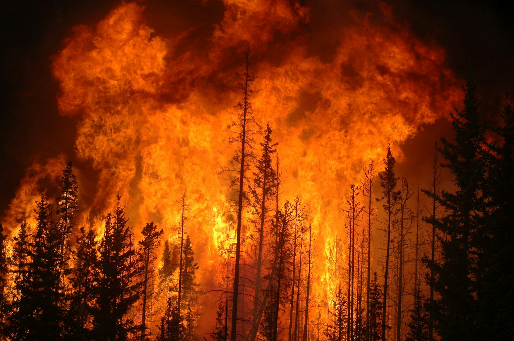
Effects of Climate
Climate change has already impacted the forests, grasslands and shrublands in the ecoregions of the Fountain Creek watershed.
- Encroachment and fragmentation, erosion, invasive insects and plants, loss of connectivity and wetlands may impact habitat, migration corridors, biodiversity, and ecosystem services.
- Forests contribute significantly to the beauty and functioning of the watershed. Forest health risks grow as average daily temperatures increase by raising wildfire, insect and disease threats according to the forest health index specific to the Fountain Creek Watershed.
- One result of wildfire includes non-vegetated land on steep slopes. Landslides, mudslides and debris flows In these areas have negative consequences not only on water quantity and quality but also water systems by filling reservoirs with sediment and washing out or undermining distribution pipelines.
- Landslides and debris flows may also cause property damage and potentially injure individuals caught up in a slide situation.
- Watershed health may also be degraded by poor air quality from wind-blown dust (particulates), mining, construction, and other dust-generating activities as well as fossil fuel pollutants from vehicles and power-generating utilities.
- Ash from wildfires as far away as California can cover winter snowpacks causing premature melting. This causes erosion and the need for additional water storage.
- Loss of natural, vegetative cover may be caused or exacerbated by:
- Tree damage, disease, insects
- Drought
- Wildfire
- Mining (gravel, rock, metals)
- Recreation and intensity of use
- Flooding, erosion, and sedimentation
- Particulate pollution
- Loss of habitat and biodiversity may be caused or exacerbated by:
- Longer fire season
- More complex or uncharacteristic wildfires
- Drought
- Increasing pressures
- Water availability
- Population growth
- Invasive species
- Climate change
Natural Infrastructure
- Natural infrastructure resilience and sustainability practices that may reduce risk and improve watershed health:
- Forest and grassland condition monitoring and management
- Scientific research
- Conservation
- Pest management
- Forest thinning
- Conservation leases and easements
- Open space retention and protections
- Agricultural land preservation
- Native plants
- Tribal traditional ecological knowledge practices
Built environment
- Built infrastructure resilience and sustainability practices that may reduce risk and improve watershed health:
- Green infrastructure
- On-site stormwater management
- Compact, mixed use and low impact development
- Multimodal transportation
- Net zero energy, water, and waste
- Floodplain restrictions and management
- Open space and recreational trail development and use
- Stream restoration
Additional Resources
2023 Report on the Health of Colorado's Forests
Grassland, Colorado Parks and Wildlife. Retrieved Mar 2024
Oak Shrublands, Colorado State Forest Service. Retrieved Mar 2024
Shrubland, Colorado Parks and Wildlife. Retrieved Mar 2024
Ecological Systems of Colorado, Colorado Natural Heritage Program, Colorado State University, 2024. Retrieved Mar 2024
DISCLAIMER
Information for this webpage was originally compiled and submitted by the author as part of the Peak Progress: Quality of Life Indicators (QLI) update published in 2022 by the Pikes Peak United Way. It is intended to describe the health and current condition of the Fountain Creek Watershed. It provides a basis for describing how well the watershed is functioning; how it may be affected in the future by wildfire, drought, extreme weather, population growth, urban development, and pollution; and possible initiatives to protect and conserve it for current and future generations. Last updated by the author February 2024.
Potential for Action
Ideas to conserve and improve Fountain Creek and the watershed:
Education and Outreach
- Make residents, institutions, and businesses aware of their everyday and continuing impacts on runoff, water quality, and watershed health.
- Conduct anti-litter campaigns and periodic cleanup efforts.
- Bring understanding to citizens on a regular basis about how their actions affect storm water, collection systems and operations; likewise, how what goes down the drain may affect wastewater collection and treatment systems.
- Inform residents periodically about activities and projects in Fountain Creek and its tributaries.
- Provide educational resources about how to integrate on-site stormwater management techniques such as use of rain gardens, permeable surfaces and rain barrels, drought-tolerant native plants, and water conservation techniques in landscapes.
- Reach out to citizens regularly to bring awareness and a desire to protect the watershed, e.g. Leave No Trace, Creek Week, pet waste collection, landscape pesticides, oil spill cleanup, etc.
- Encourage opportunities to bring people closer to our creeks through cleanups, restoration activities and recreation in order to foster awareness and a desire to protect the watershed.
- Support nature centers, nonprofits, clubs, and other entities that educate people about the watershed.
- Organize volunteers to take individual and group actions to educate others and to take positive steps to improve watershed health.
Water Use
- Adopt regional policies that implement the water quantity goal in the sustainability framework “Looking to Our Future: Pikes Peak Region 2030”, March 2012:
- By 2030, the region’s water use is met by currently owned water supply and is as efficient as possible through application of best management practices. Achieving this goal means:
- The region utilizes 100% of its reusable water supplies, including but not limited to, non-potable water, exchange programs, and transmountain water.
- Residential water use is at or below 80 gallons per person per day; 80% of commercial and industrial users in the region employ best water management practices.
- Landscaping for each intended use is resource efficient.
- And adopt policies that affect water quantity and use in other goals including agriculture and built and natural environment.
- By 2030, the region’s water use is met by currently owned water supply and is as efficient as possible through application of best management practices. Achieving this goal means:
- Adopt policies to protect and replenish local groundwater supply.
- Consider updating zoning and other regulations to limit the amount of nonfunctional turf in new development or redevelopment.
- Use native grasses and plants in landscaping in lieu of turf or large expanses of rock, which can increase localized ambient temperatures.
- Implement incentives and education to support homeowners and businesses who want to replace turf, plant native vegetation, and improve irrigation systems
- Continue to implement incentives to improve water conservation and reduce demand for water indoors and outdoors
Water Quality
- Continue to conduct and improve water quality monitoring throughout the watershed and target areas for improvement. Implement new monitoring as applicable.
- Continue to sample, monitor, and collect data to determine if reduction strategies in the US EPA 9-Element E. coli Watershed Plan have been applied and are working.
- Consider treatment requirements for certain industries, operations, or activities that discharge into sewage systems or whose operations may introduce non-regulated pollutants (such as PFAS) into the environment.
- Inspect, repair, and replace on-site septic systems especially between and within Woodland Park and Manitou Springs.
- Inspect, repair, and replace leaking wastewater collection systems throughout the watershed on a regularly scheduled basis.
- Implement better management practices to address pollution from human and animal feces in high use areas in or near water bodies (unhoused encampments, bird roosts, farm animals, dog parks, dog-friendly trails).
- Consider grants, no/low interest loans, or other means for businesses and homeowners to make improvements on their property to reduce pollution and runoff from hard surfaces, replace lawns with drought-tolerant native plants, implement fire mitigation and replace failing septic systems.
Land Use, Development and Stormwater Management
- Incorporate smart growth principles, low impact development, green infrastructure, and stormwater best management practices (BMPs) in subdivision and other appropriate land use policies and regulations for new urban development, infill and redevelopment that will reduce the amount and timing of runoff from hard surfaces (rooftops, driveways, parking lots, roads, etc).
- Fund retrofits to improve existing, conventional detention basins and include BMPs for managing the quality, volume, and rate of runoff.[i]
- Permit, inspect and enforce stormwater management standards on construction projects and industrial sites in accordance with regulatory standards and best practices.
- Discourage development in the WUI, create defensible space, encourage/require Firewise.org standards in construction, prevent ignition, provide awareness and education, and provide fire mitigation assistance.
- Integrate net zero energy, water, and waste standards in building codes (new construction and existing building upgrades/retrofits) using Leadership in Energy and Environmental Design (LEED)[ii], Living Building Challenge[iii] or similar guideline.
- Address negative impacts from human activities within the 100-year floodplain to protect the watershed, people, and economy of the region.
Watershed Restoration and Resilience
- Fund and implement restorative streambank stabilization and mitigation throughout the watershed, especially in areas with potential for property loss and infrastructure damage from flooding, erosion, and sedimentation and/or riparian or wetland habitat impacts.
- Remove invasive and non-native species such as Russian olive[iv], phragmites[v] and tamarisk[vi] and replace with native plants.[vii]
- Develop and enforce policies to preserve and enhance habitat, biodiversity and ecosystem health and services within the watershed.
- Manage private and public lands to conserve, protect and restore forests, grasslands, wetlands, and other habitats.
- Improve water and wastewater infrastructure resilience and protection in areas with moderate to high risk of wildfire.
Climate and Sustainability
- Support agencies that gather water data that help guide improvements and understanding of the effects of severe storms, drought, higher temperatures, and other impacts of changing climate on the watershed, Fountain Creek and its tributaries.
- Take a leadership role to reduce greenhouse gases in governmental planning, operations, logistics, buildings, projects, and activities.
- Provide appropriate legislative incentives and disincentives to reduce greenhouse gases in housing, utility, transportation, commercial, agricultural, and industrial sectors.
- Reduce water use in all sectors and consider wastewater reuse alternatives in order to operate with existing water rights and resources.
- Increase the use of renewable energy and reduce the use of coal, oil and natural gas for power generation and heating.
- Improve mobility by providing multi-modal options such as mass transit and cycling.
- Encourage low impact development that is mixed use, accessible and connected with the community by walking, wheelchair, or means other than a motorized vehicle.
- Avoid building and expanding hard surfaced highways, roads, and parking areas.
- Design transportation systems to better manage, control and treat water runoff from highways, roads, and parking surfaces.
- Improve recycling programs to reduce waste to landfills thereby reducing methane, a greenhouse gas as well as to reduce litter and waste throughout the watershed.
- Consider how to reduce greenhouse gases, air, water, and land pollution by altering supply chain inputs and outputs (including source materials, energy and water use, transport, distribution, storage, processing/manufacturing, waste, product end-of-life).
- Take advantage of employment and economic opportunities presented by clean power jobs, restorative and regenerative agriculture, environmental tourism, and outdoor recreation, cleantech research and development and other opportunities presented by the challenges of climate change.
Innovation and Collaboration
- Collaborate to make Fountain Creek an amenity (Crown Jewel) and centerpiece of watershed health, economic prosperity, and social equity.
- Fund monitoring, conservation, restoration, and other projects to protect and enhance the watershed.
- Partner to establish conservation leases/easements, parks, and open space to preserve and protect farms and ranchland and other natural areas (undeveloped, permeable surfaces; biodiversity; viewshed, etc).
- Partner with the US Forest Service, Natural Resource Conservation Service and other federal, state and county agencies as well as landowners to implement conservation, restoration, and regeneration programs throughout the watershed.
- Establish relationships and agreements to achieve the vision plan for Fountain Creek and to manage projects within the watershed that meet the needs of current and future generations with respect to water availability and water quality, water rights, local food, environmental health, renewable/sustainable energy, and mobility alternatives.
- Seek to encourage and finance innovative clean technologies and supply chain research as well as green and socially conscious startup businesses, pilot, and demonstration projects.
[i] Pennsylvania Environmental Council (Sep 06 Improving Stormwater Detention Basins for Better Stormwater Management Retrieved from https://wrrc.arizona.edu/publications/water-harvesting/improving-stormwater-detention-basins-better-stormwater-management Oct 2021
[ii] US Green Building Council (n.d.) Green Building 101: What is LEED? Retrieved from https://www.usgbc.org/articles/green-building-101-what-leed Nov 2021
[iii] International Living Building Institute (2021) Retrieved from https://living-future.org/lbc/basics4-0/ Nov 2021
[iv] Laity, Debbie (Feb 2014) Russian-olive Trees Are Considered a Noxious Weed in Colorado.
[v] US Fish and Wildlife Service (Nov 2007) Phragmites: Questions and Answers
[vi] Colorado Department of Agriculture (2021) Tamarisk Biocontrol. Retrieved from https://ag.colorado.gov/conservation/biocontrol/tamarisk Oct 2021
[vii] Colorado State University Extension (2021) Natural Resources. Retrieved from https://extension.colostate.edu/topic-areas/natural-resources/?target=publications#native (Oct 2021)
DISCLAIMER
Information for this webpage was originally compiled and submitted by the author as part of the Peak Progress: Quality of Life Indicators (QLI) update published in 2022 by the Pikes Peak United Way. It is intended to describe the health and current condition of the Fountain Creek Watershed. It provides a basis for describing how well the watershed is functioning; how it may be affected in the future by wildfire, drought, extreme weather, population growth, urban development, and pollution; and possible initiatives to protect and conserve it for current and future generations. Last updated by the author February 2024.
Please contact the author maryjbarber1@gmail.com with questions or comments.
Linked Documents and Third Parties
Please note that this site may link out to third-party websites that do not have accessible content. This site may also include documents provided by third parties. While we cannot control the accessibility of content provided by third parties, we are happy to assist any member of the public with reading and accessing content on our site. The Compliance Coordinator may be contacted at fcwdaa@gmail.com.
