
Fountain Creek Greenway Master Plan
Click the image below to see the final Fountain Creek Corridor Greenway Master Plan, December 2022

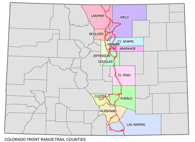
In 2003, the vision for the Colorado Front Range Trail (CFRT) was introduced by Colorado Parks and Wildlife (CPW). At 876-miles, and spanning 15 cities and 14 counties, the CFRT will connect communities along Colorado’s front range from Wyoming to New Mexico.
While several communities throughout Colorado have completed segments of the CFRT, many gaps remain. Since its formation in 2009, one of the District’s primary goals has been to close the CFRT gap between Colorado Springs and Pueblo. The first step in achieving this goal was completed in 2011, when the District completed the Fountain Creek Corridor Restoration Master Plan.
The focus of the Master Plan was identifying creek restoration and rehabilitation projects, as well as preliminary alignments for the CFRT, and seeking opportunities to incorporate trail design and construction with creek restoration or other recreation projects. This effort was hugely successful as several trail and parks projects that were identified in the Master Plan have been completed in the City of Colorado Springs, City of Fountain, El Paso County, Pueblo County and the City of Pueblo. This includes the CFRT through Clear Springs Ranch. The effort to close additional gaps in the CFRT received a boost when, in 2015, former Colorado Governor John Hickenlooper unveiled the Colorado the Beautiful Initiative. The initiative identified the CFRT as one of the top 16 priority regional trail connections in Colorado, making it eligible for prioritized funding through the GOCO Connect Initiative.
The District has now taken the next step in closing the largest gaps of the CFRT from Colorado Springs to Pueblo. After partnering and receiving grant funding from GOCO and CPW, the District has begun an effort to identify a detailed alignment for the CFRT called the Fountain Creek Greenway Master Plan. Coordinating with land trusts, private property owners and government agencies, the Master Plan will explore sustainable trail alignment opportunities and alternatives through the Fountain Creek Corridor. The plan will also seek to promote stewardship as a part of the larger goal of protecting the Fountain Creek Corridor.
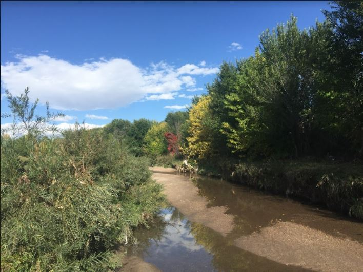
The Fountain Creek Corridor Greenway winds through portions of Teller, El Paso and Pueblo Counties including eight municipalities: Pueblo, Colorado Springs, Fountain, Manitou Springs, Green Mountain Falls, Woodland Park, Palmer Lake, and Monument.
Some agricultural uses exist within the floodplain area and are likely to remain. The unique geography of the District serves to define a sensitive area for water-quality protection and wetland preservation functions. As such, this area should continue to be protected by limiting development in and near the greenway corridor boundaries. Any proposed development within the boundaries will need to adhere to the District’s land use standards.
The Master Plan effort was originally scheduled to be completed at the end of 2020. Given social gathering restrictions put in place due to the COVID-19 pandemic, the project schedule was extended until the end of 2022. The final Fountain Creek Corridor Greenway Master Plan was released in December 2022.